
Operation Market Garden
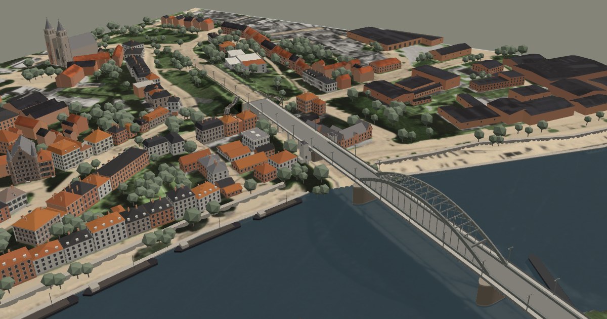
The Arnhem road bridge in September 1944: a 3D model
On 12 September 1944 an RAF reconnaissance aircraft photographed Arnhem from straight above. Five days later the 1st Airborne Division landed west of the town, and on the evening of 17 September Lieutenant-Colonel John Frost's men reached the north end of this bridge.
I have rebuilt the bridge and the streets around its north ramp as they stood that week, on top of that photo. Turn it, zoom in and look at the ground the way the paratroopers saw it: the ramp, the houses they held, and the open stretch of road that was fought over for three and a half days.
How to use
- Mouse: drag to turn, right-drag to move, scroll to zoom.
- Touch: drag with one finger to turn, use two fingers to move and zoom.
- Keyboard: arrows or WASD to move, Q and E to turn, N for north up.
- The buttons in the panel jump to set views, such as the north ramp or the view from the Eusebius tower.
About this model
The ground is the RAF vertical photograph of 12 September 1944. The bridge is built from its monument description and from period and present-day photos. The houses near the bridge are drawn from wartime photos and postcards; buildings further away are simplified. Many building heights are estimates, and the model is a work in progress: I keep refining it as I find new sources.
Credits
Ground photo: RAF vertical photograph, 12 September 1944, Nationaal Archief, The Hague (2.24.05.02, inv. 141-0015). 3D rendering: three.js (MIT licence).
Want to stand on this ground yourself? I guide tours of the bridge and of the whole Market Garden battlefield.